Cattaraugus County Geology Trail
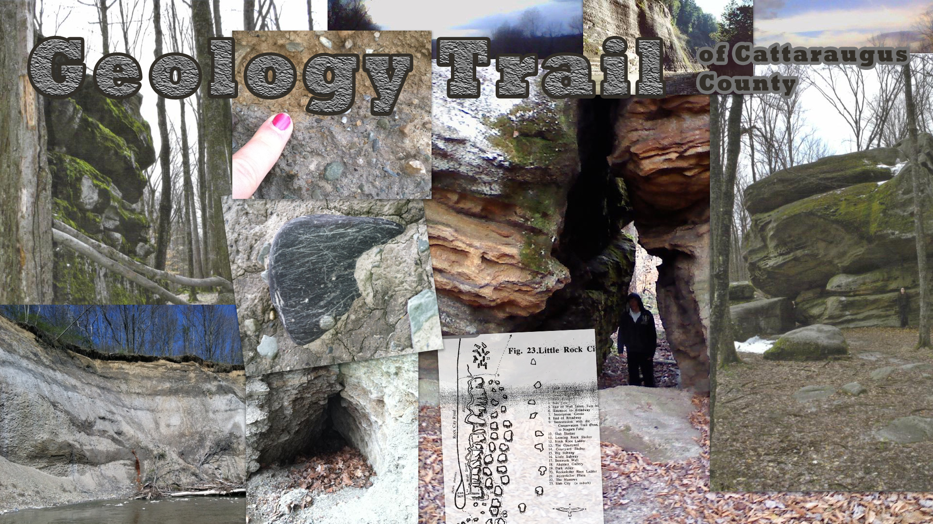
Many people are surprised to hear of the natural wonders that can be found less than an hour south of the great Niagara Falls in the quiet, rural Cattaraugus County. Rock cities, ancient glacial valleys, vertical-cliffed gorges, and continental divides are just a few of the sights one may see on a day trip through the area.
Entirely situated on the western flank of the Allegheny Plateau, Cattaraugus County sits at an average elevation of about 1800 feet above sea level. Ironically, most of the exposed bedrock one will encounter was deposited in a calm and quiet sea nearly 300,000 years ago during the Devonian Period.
Cattaraugus County boasts a top ski resort destination in the eastern U.S. due to some relatively high-relief. The Allegheny Plateau is deeply dissected mainly due to river flow since the retreat of the Devonian sea. However, the most recent Ice Age (65,000-10,000 years ago) has also played a key role in the present shape of the land.
In September 2011 an advanced class of high school Geology students from Cattaraugus-Little Valley High School began research and observations of several sites of geologic interest in Cattaraugus County. Each site will open a new door to the rich geologic history of Cattaraugus County, as well as western New York State.
The following is a small portion of the students’ research. It should be noted that the students are high school-age and their work was edited by their Geology teacher. Most information is accurate, but may be slightly incomplete, as this is a work in progress.
If you have any productive questions or comments, please feel free to email Kelli Grabowski (Earth Science and Geology, Cattaraugus-Little Valley HS) kgrabowski [at] cattlv [dot] wnyric [dot] org
Geologic Stops
- Dobbins Memorial State Park - "Dobbins may be just like Little Rock City, where the area wasn’t touched by glaciers or it may be made of glacial till."
- Little Rock City - "unique due to the large rock formations that are visible and scattered throughout the surrounding area. The formation of the geologic site has been very controversial due to the fact that it was never affected by glaciers during the last ice age 20,000 years ago, a fact unknown to many people."
- Otto Stadial Site & Gowanda Interstadial Site - "Otto is one of only two known places in New York to have preserved till layers from first three glacier movements (of four) during the Pleistocene Ice Age. Here you will find yourself hiking along the bank side and experiencing things that you have never seen before."
- Scoby Dam Area - "The bedrock surrounding the Scoby Dam area was formed during the Devonian time period and is mostly fissile shale and siltstone."
- Thunder Rocks - "Most people believe that glaciers were the reason Thunder Rocks appeared, but this is not true. Instead, the giant rocks were made due to a number of things"
- Zoar Valley - North Otto Water Access - "The Cattaraugus Creek cut through the shale at a rate of 15 to 18 feet per thousand years and formed the valley walls we see today over a period of 14 to 15 thousand years."
- Zoar Valley - Valentine Flatts - "awed by the magnificent cliffs at each side of the river bed"
- Rock City Park - Rock City Park is a majestic geological spectacle of enormous rock formations and is sometimes called one of the Eighth Wonders of the World. This prehistoric ocean floor is the World’s largest exposure of quartz conglomerate (also called ocean spar or puddingstone) and attracts thousands of visitors yearly.
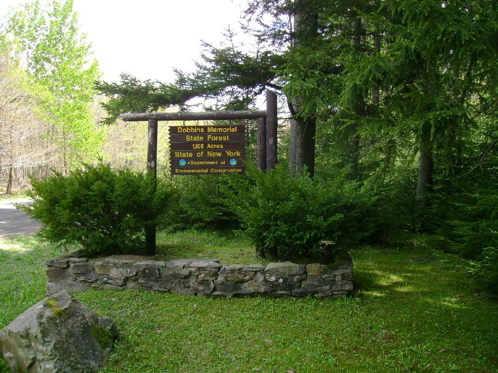
Dobbins Memorial State Forest
Location
Dobbins Memorial Forest is a New York State Forest. It was a forest that was started in the 1930’s when Franklin D. Roosevelt sent the CCC to plant thousands of trees. Harry Dobbins was a forester that had a part in purchasing many NYS Forests.
There are many different recreational activities that you could do. Some of the activities that you could do are hiking, camping, snowmobiling, hunting, snowshoeing, mountain biking, and horse riding. In Dobbins Memorial Forest there is a spot for geo-cashing.
Located at 42⁰ 17’ 122”N, 78⁰ 46’ 980”W the geologic situation of Dobbins Memorial Forest is unique and a little obscure. It’s located between Linlyco Lake, which was affected by glaciers and Little Rock City which was left unglaciated. When driving through the many valleys surrounding Dobbins you will notice their large U-shaped structures.
There is not any bedrock visible in the forest but there is a layer of soil that covers the till and bedrock. The till that is covering the bed rock was deposited by a glacier that was sitting still making the hill a moraine. Soil is on top so you can’t see the till or bedrock. Dobbins may be just like Little Rock City, where the area wasn’t touched by glaciers or it may be made of glacial till. It is difficult to tell due to the thick soil cover. Dobbins Memorial Forest is an interesting place to explore with many hidden geological secrets. See what you can find today!
Map
Check out Our Map! Note, there are two points: one for parking, one is in the thick of the forest. View the map at http://www.zeemaps.com/map?group=368353
Directions
From Interstate 90 (Buffalo)
- Slight right onto US-219 S (signs for Orchard Park/Springville) (28.4 mi)
- Turn right onto US-219 S/Peters Rd (0.3 mi)
- Turn left onto US-219 S (13.7 mi)
- Turn right onto NY-242 W/US-219 S
- Continue to follow NY-242 W (3.8 mi)
- Turn right onto Co Rd 15/Dublin Rd (2.5 mi)
- Turn right onto Bedient Hill Rd
- Parking area will be on left
From Interstate 86 (Erie)
- Take exit 16 toward Randolph/Gowanda (0.2 mi)
- Turn left onto W Main St (2.7 mi)
- Continue onto NY-394 E/Hall St
- Continue to follow NY-394 E (0.6 mi)
- Turn left onto NY-242 E (9.5 mi)
- Turn left onto Erie St (0.4 mi)
- Turn right onto N 9th St (0.4 mi)
- Continue onto Co Rd 14/Kahler Hill Rd
- Continue to follow Kahler Hill Rd (0.6 mi)
- Slight right to stay on Kahler Hill Rd (1.7 mi)
- Turn right onto Bedient Hill Rd
- Parking area is a quick right
From Interstate 86 (Elmira)
- Take exit 20 to merge onto NY-417 E toward NY-353 (1.0 mi)
- Turn left onto NY-353 N/Center St
- Continue to follow NY-353 N (5.8 mi)
- Turn right toward NY-242 E (0.2 mi)
- Turn right onto NY-242 E (1.0 mi)
- Slight left onto Co Rd 15/Dublin Rd (1.4 mi)
- Continue onto Bedient Hill Rd
- Parking area will be on left
GPS Coordinates
42⁰ 17’ 11” N
78⁰ 46’ 58” W
Information compiled by Drew Hill and Logan Martin 5/31/2012 for the Cattaraugus County Geology Trail
Pictures
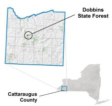
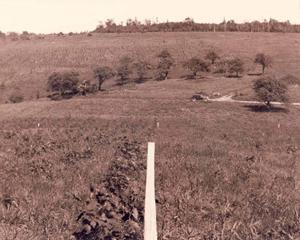
Where Dobbins Memorial Forest is located in Cattaraugus County
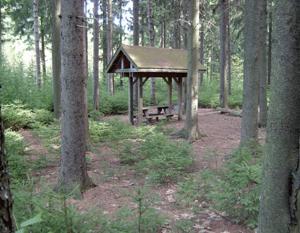
This feature is a place right next to the entrance for seating and gatherings.
Dobbins Memorial Forest was once a place that was used by local farmers for crops and feed for their cattle before the CCC planted the forest.
Little Rock City
Location
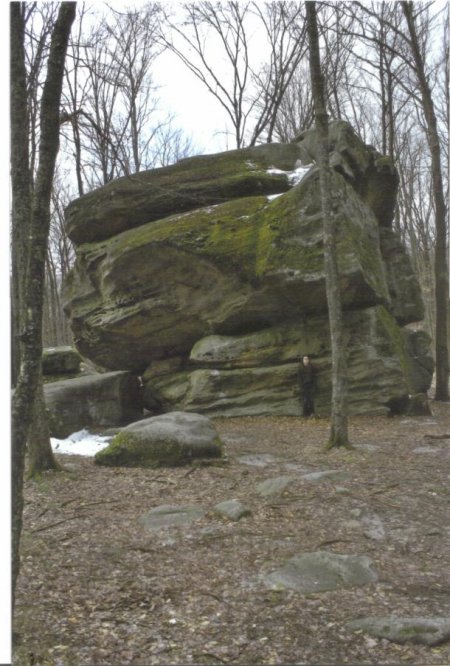
Little Rock City is a local landmark of geologic interest. Located at 42° 12’ 31” N, 78° 42’ 31” W, Little Rock City is located north of Rock City State Forest and is accessible in the spring, summer, and fall by vehicle, and during the winter by snowmobile. If you are traveling to the site by vehicle, the roads that you drive on were created during President Roosevelt’s CCC (Civilian Conservation Corps) plan to produce jobs for those who were unemployed and in need of work.
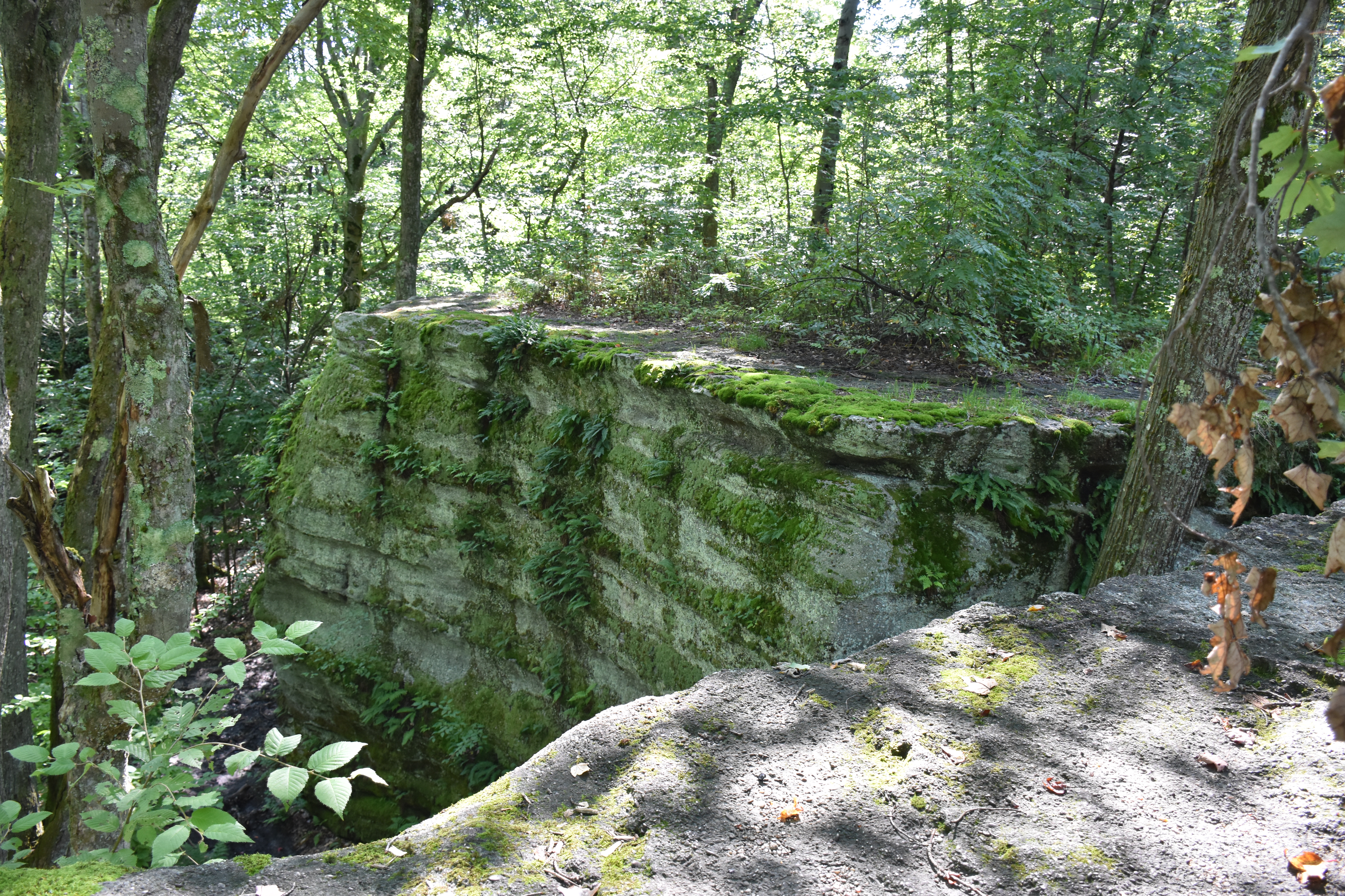
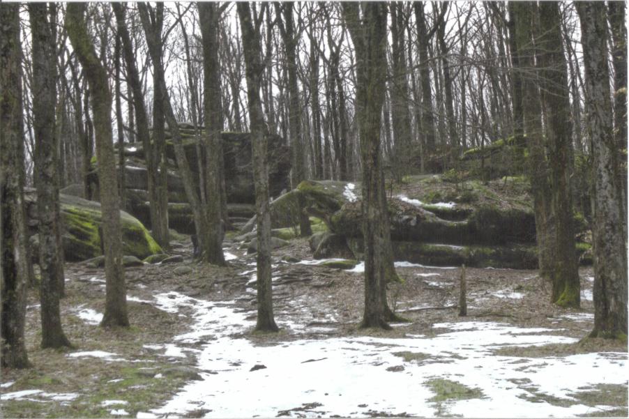
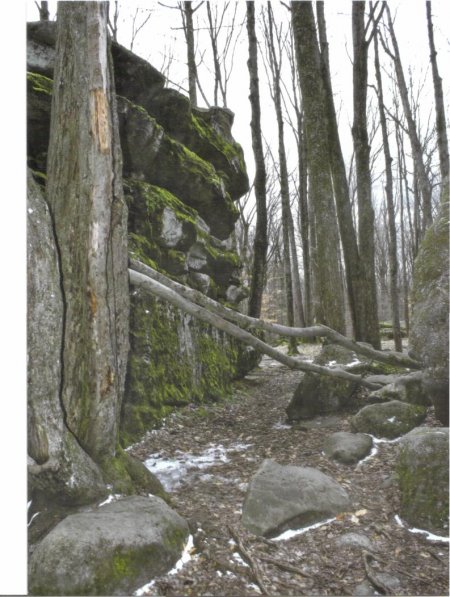
Little Rock City is unique due to the large rock formations that are visible and scattered throughout the surrounding area. The formation of the geologic site has been very controversial due to the fact that it was never affected by glaciers during the last ice age 20,000 years ago, a fact unknown to many people. If Little Rock City had in fact been affected by glaciers, the site we see today would most likely not be present due to destruction by the large ice sheets.
Today, we know that Little Rock City was not formed by glaciers, but actually formed through mountain building events known as orogenies. As sediment from surrounding areas was deposited over Rock City State Forest, the base for Little Rock City was formed. As hundreds of years passed, gravity erosion of the landscape began to separate non-resistant rock layers from those which were highly resistant, leaving us with the large boulders that are present today.
People travel to Little Rock City for many different recreational activities. Some things that you may do while at the site include camping, hiking, picnics, biking, and rock climbing/bouldering… the possibilities seem endless. The best part though is that it is free to come and do whatever you would like! Although it is still a state forest so four wheeling and other motorized recreational vehicles are prohibited and use can result in fines.
Information compiled by Jacob Shawley and Matt Booth 5/31/2012 as part of the Cattaraugus County Geology Trail
Directions
From Salamanca
- Take Route 353 north towards Little Valley
- Turn right on Whig Street
- Stay on Whig Street for 2 miles until Hungry Hollow Rd. Turn Right. (The road is across from Whig Street Church)
- Drive 1.1 miles up Hungry Hollw Rd. Turn right on Little Rock City Rd. and follow it until cul-du-sac at the end, 1.9 miles.
From Buffalo
- Take Route 62 South through Gowanda
- Turn left onto Route 353, through Cattaraugus and Little Valley
- Turn left on Whig Street.
- Stay on Whig Street for 2 miles until Hungry Hollow Rd. Turn Right. (The road is across from Whig Street Church)
- Drive 1.1 miles up Hungry Hollw Rd. Turn right on Little Rock City Rd. and follow it until cul-du-sac at the end, 1.9 miles.
Map of the area
Click the following to view a map of the area and site marker:
http://www.zeemaps.com/edit/tp36aeGC4kdLwZZHWjcdJw#
Pictures
Big rock formations like this pictured above are visible throughout the entire area, all telling their own story about geologic activities that have taken place.
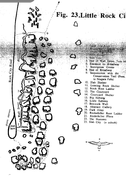
The figure above shows the layout of little rock city at its present location if you were to visit it today.
Otto Stadial and Gowanda Interstadial
Location
Information compiled by Liesel Rickert and Chantel Abramowski 5/31/2012 for the Cattaraugus County Geology Trail
Stadial site in Otto
The stadial site in Otto is a place like no other. Otto is one of only two known places in New York to have preserved till layers from first three glacier movements (of four) during the Pleistocene Ice Age. Here you will find yourself hiking along the bank side and experiencing things that you have never seen before. The till was deposited by the Wisconsin glacial event that occurred about 64,000 years before present to about 12,300 years before present, during the Pleistocene Epoch and covered almost all of New York. Each layer was deposited by a different advancement of the glacier (caused by cooling and warming). These are called stadials and interstadials respectively.
If you aren’t in any hurry you can take a scenic route to the site and see what interesting things you might find. Along the way you will be fascinated by the rock patterns along the creek bottom or other evidence that a glacier activity had occurred several times in New York’s geologic past. These include different colors of each till layer (because they are made up of different types of soils and bedrock sediments), striations on rocks (scratches from the glacier moving over the rocks), compacted masses of till (which means it was not sorted by size of particles), and angular rocks (rocks are rounded when moved by a stream but not when moved by a glacier). Once you have arrived at the stadial site you will be in utter amazement just by seeing the preserved piece of geologic past that lays right before your eyes.
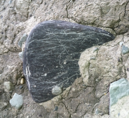
Striations on rock at Otto stadial site.
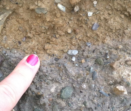
Two adjacent till layers at Otto stadial site
Gowanda Hospital Interstadial Site
To top it all off you can go visit the Gowanda Hospital Interstadial Site afterwards to fulfill your fascination which is only a mere 20 minutes away. This is the other site in Western New York that shows the till layers dropped by each retreat. Both sites have till layers that look similar and seem to be deposited at the same time by the same glaciation. So come on down to Otto and Gowanda, New York to experience the history that shaped our state. You will not come across places like these everyday so why not take advantage of it now and start your adventure today!
Map of sites
Map is at http://www.zeemaps.com/pub?group=368344&x=-78.841592&y=42.484840&z=7
Directions:
Otto Stadial Site
Otto Stadial Parking Coordinates: 42°21’3.744’N, 78°50’17.894”W (updated 2017-06-16)
Otto Stadial Site Coordinates: 42°21’8.849’N, 78°49’55.696”W
Park at coordinates given. 1) Walk down to the creek on the south side of the parking lot and follow to the left to reach the strata layers. To the right you will find till and other evidence. 2) Head east on the road next to the parking lot until you see the bridge before you. Before you reach the bridge, turn off into the field to the right (at 42°20’34”N, 78°48’44”W) and head down to the Cattaraugus Creek on the left. The strata will be in front of you.
Gowanda Hospital Interstadial Site
Gowanda Hospital Parking Coordinates: 42°29’42.8”N, 78°55’41.8”W (updated 2017-06-16)
Gowanda Hospital Interstadial Site Coordinates: 42°29’41.5”N, 78°55’50.6”W (updated 2017-06-16).
Park alongside the road.
Scoby Dam and Route 219
Location
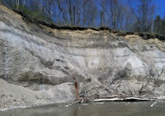
Scoby Dam is most commonly known because of its trail and of course the dam but it is also has a lot of geological elements that have built the area.
The bedrock surrounding the Scoby Dam area was formed during the Devonian time period and is mostly fissile shale and siltstone. The soil in area is made up of very fine grained clay that is prone to landslides. Any clearing of vegetation also makes landslides more probable. The landslides have caused damage to the area and have affected the construction of Route 219 and the major bridge(s) over Cattaraugus Creek.
There is a cave that you can barely see that you have to climb up in order to actually get a good look. It is said that you shouldn’t go in it because it is really small may exist due to fractured and unstable shale layers.
Information compiled by Dakota Chinchen and Courtney Geis 5/31/2012 for the Cattaraugus County Geology Trail
Pictures
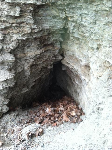
The Scoby Dam Cave located within a wall of shale along the banks of the Cattaraugus Creek.
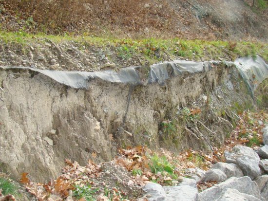
A bank along Cattaraugus Creek. The black tarp is used to hold up the bank.
Map of Study Area
Visit the site below to see the location of our study area:
http://www.zeemaps.com/pub?group=368348&x=-798.700390&y=42.483377&z=0
Thunder Rocks at Allegany State Park
Location
Thunder Rocks is a rock city that is located in Allegany State Park. It is made up of huge rocks that you can observe and walk up to. It is a great place to visit with your family or to study the geologic history of New York.
The geology of Thunder Rocks is very interesting and the creation of this large rock city is unique. Most people believe that glaciers were the reason Thunder Rocks appeared, but this is not true. Instead, the giant rocks were made due to a number of things.
A long time ago (about 360 million years ago) New York State, along with Allegany State Park was covered by a large, shallow sea. The nearby Catskill Mountains were formed to the east during this time. Sediment from these mountains eroded westward towards western New York and deposited within this area. Thunder Rocks is made up of this sediment. Over some time, frost wedging and gravity erosion shaped the boulders into their present arrangement. Gravity was able to pull the large rocks down some slopes and hills. This resulted in the rocks being scattered away from each other.
While this is the most accurate evidence of how Thunder Rocks formed, some people still think glaciers caused their appearance. But this can not be true because Allegany State Park is part of what is called the Salamanca Re-entrant. This is a small area of New York State that has been untouched by glaciers. Thunder Rocks is also included in this area. This means glaciers were definitely not the reason for their formation. The process that occurred throughout New York’s geologic history is very interesting, especially when it comes to the history of Thunder Rocks. This makes it all the more reason to visit these uniquely huge slabs of bedrock!
Information compiled by Riley Brumagin and Owen Dudley 5/31/2012 for the Cattaraugus County Geology Trail
Photos
Maps & Coordinates
Coordinates: 42°02′32.5″N 78°42′05.5″W
The red area on the map represents the Salamanca Re-entrant. This is the only area of New York State that has been untouched by glaciers.
Visit the following site to see an accurate plot of this area on a map:
http://www.zeemaps.com/pub?group=368349&x=-78.701534&y=44.116457&z=11
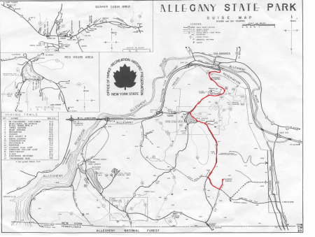
Old Allegany State Park Guide Map showing how to get to Thunder Rocks from Salamanca
Zoar Valley - North Otto Water Access
Location
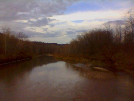
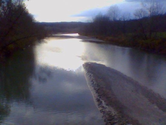
The Zoar Valley Parking Area on North Otto Road has access to the Cattaraugus Creek.
Fishing
Depending upon the time of year, you could catch Steelhead(rainbow trout) and other kinds of trout on the Cattaraugus Creek. Get the map
Canoeing & Kayaking
Canoeing and kayaking is not a recommended starting point for beginners or intermediate paddlers. It is dangerous in this section of the Cattaraugus Creek and people die or get seriously injured in Zoar Valley every year. Get in touch with the Zoar Valley Paddling Club to learn where to paddle on the Cattaraugus Creek.
Geology
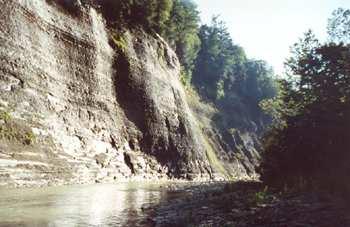
The Zoar Valley area is very unique river valley because it was formed as a result of glacial melting and deposition of sediments that the glacier carried. There were a series of glaciers that covered and exposed the Cattaraugus County area. These glaciations include the Wisconsin Glaciation, the Olean Glaciation, and the Kent Glaciation. The first glaciation began about 65,000 years ago. Sediments, known as glacial till, built up as the glacier began to retreat creating a wall, known as a moraine. As the glacier melted, large amounts of water began to flow east along the moraine and the glacier, towards Lake Erie, following a natural dip in bedrock as well as an ancient river valley. This process eventually led to the formation of the Cattaraugus Creek, which formed Zoar Valley.
The rock underlying the glacier was shale, which is very brittle and easily eroded. The power of the water flowing cut through the glacial till and bedrock and eroded at the head of the stream, backwards, in a process known as headward erosion. The Cattaraugus Creek cut through the shale at a rate of 15 to 18 feet per thousand years and formed the valley walls we see today over a period of 14 to 15 thousand years.
There are a wide variety of activities that can be enjoyed at Zoar valley. The fun ranges from hiking to rafting. You can find yourself camping in the beautiful forest, watching the wildlife, fishing, or swimming in the creek.
There are many dangers that you have to be aware of before visiting Zoar Valley. There are many steep cliffs with unstable rocks that you could cause you to find yourself in a bad situation. There have been bad incidents in Zoar Valley but they are a result of people not being aware of the dangers. The rapids can also become very fast and dangerous. They might not look like they are very strong but looks are deceiving, so make sure you are always prepared and it is recommended that you don’t adventure on your own.
Information compiled by Tiffany Anderson 5/31/2012 for the Cattaraugus County Geology Trail.
Maps
Please visit http://www.dec.ny.gov/docs/regions_pdf/zoarmapua.pdf and http://www.dec.ny.gov/lands/49452.html for a map of the Zoar Valley Multiple Use Area (MUA).
The following link will send you to a point where there is parking and water access, however; it is the easternmost point of the Zoar Valley MUA, and is separated from the main MUA and it is recommended to be respectful and mindful of any property markers.
http://www.zeemaps.com/pub?group=368364&x=-78.784836&y=42.487267&z=5
Zoar Valley - Valentine Flats
Location
Valentine Flats parking area offers a trail to an overlook or a steep trail down into the gorge.
From the Zoar Valley Multiple Use Area page on NYS DEC:
The trail north to Overlook Point is a 0.75-mile loop that includes a hogs back vantage point that juts out into the gorge.
The Valentine Flats trail to the south from the parking area is a steep trail into the gorge area, ending at the confluence of the South Branch and Main Branch of Cattaraugus Creek. This trail was an old access road leading to a former farm on the flats along Cattaraugus Creek near the confluence. The trail winds down into the gorge through the old growth hemlock/hardwood forest for about 0.8-miles. Along the flat flood plain, the trail winds through a black walnut plantation with thick brush before reaching the creek. It will take considerable time to hike in and out of the gorge. Plan for enough daylight hours to make the hike safely.
Fishing
Fish for rainbow trout(steelhead) or other trout on Valentine Flats section of the Cattaraugus Creek.
Hiking
Hike to a great place to overlook the gorge or to sit by the flowing water of the creek.
Canoeing & Kayaking
You can hike to the water but you are looking at a hike of just over 0.75 miles with your equipment.
Geology
At one point there were glaciers covering most of New York State. These glaciers melted and refroze several times. As the glaciers would melt away all that water had to go somewhere. What path would this water have taken? In order to answer this question we traveled to a local site that we suspected was formed by this leftover water. When we arrived at the site we were awed by the magnificent cliffs at each side of the river bed. We would recommend that everyone looking for amazement and adventure to travel to Zoar Valley.
Maps
If you were to go to the Valentine Flatts outlook in Zoar Valley you might find that the walls of the valley remind you of the Grand Canyon. In one way or another Zoar Valley is a small scale model of the Grand Canyon. To find out for your self put these coordinates 42.4465°N 78.9002°W into your GPS or into Google Maps and follow the directions given.
The NYS Department of Environmental Conservation has a great page about the Zoar Valley Multiple Use Area.
Information compiled by Tyler Wilder and Jacob Domes 5/31/2012 for the Cattaraugus County Geology Trail